ORBISAT
Emergency and natural disaster management

At Orbisat, we understand the importance of a rapid and effective response to emergencies and natural disasters. Our Earth observation services are designed to provide accurate and timely information crucial for the assessment, analysis and monitoring of disasters such as hurricanes, tornadoes, fires, volcanic eruptions, earthquakes, floods and hurricane damage around the world.
24/7 monitoring
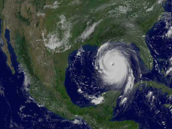
Our satellites allow continuous monitoring of critical environmental conditions. We follow the path of hurricanes to facilitate preventive evacuations, we detect outbreaks of forest fires to coordinate extinction efforts, we locate volcanic eruptions and floods almost in real time. The data obtained, combined with AI and ML algorithms, helps detect changes and quickly assess the environment and damage to infrastructure.


Damage Assessment
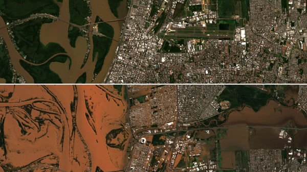
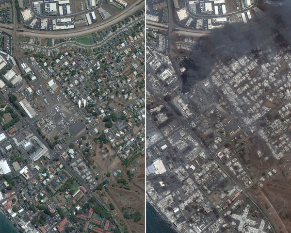
After a disaster, our high-resolution satellite images and geospatial analysis software allow you to quickly assess damage. We produce strategic planning models that help predict and control disasters as they occur, such as earthquakes or floods. Using multispectral satellite imagery, we can separate materials within a map and make accurate interpretations of damage before and after the disaster.
Prevention and Mitigation
Our remote sensing data is essential for identifying vulnerable areas and monitoring risks, such as floods and landslides. This allows operators and planners to better assess the risk and vulnerability of their regions, prioritizing preparedness and mitigation activities. Estimates of the particular types of land cover that may be affected by a natural disaster facilitate preventative planning.


Collaboration and Support
We collaborate with governments, NGOs and international agencies to integrate our images into emergency management systems, improving coordination and response to disasters. We provide population density mapping for resource allocation, safe routes for search and rescue teams, and damage assessment analysis to government and private infrastructure.


Key Applications
The use of multispectral satellite images is crucial for the separation of materials within a satellite map and for the interpretation of damage in pre- and post-disaster assessments. Satellite remote sensing helps acquire real-time data to monitor the environment, assess infrastructure damage, and assist in recovery using artificial intelligence and machine learning algorithms for change detection. These applications include:
Disaster Recovery: We provide essential data for post-disaster recovery, including reconstruction and damage assessment.
Emergency Management: We help in the planning and execution of rescue and relief operations.
Search and Rescue: We facilitate the location of safe and obstacle-free routes for rescue teams.
Monitoring Weather Patterns: We monitor climate changes that may indicate future disasters.
Flood Assessment: We identify flooded areas and estimate the impact on land cover.
Drought Predictions: We monitor and predict drought conditions for agricultural and water resources planning.
Reconstruction: We provide detailed data for the reconstruction of affected infrastructure.
Mapping of Danger and Emergencies Zones: We identify high-risk areas to implement preventive measures.
With our images, it is possible to obtain:
Population density maps for resource allocation.
Safe and obstacle-free routes for search and rescue teams.
Pre and post event images to evaluate damage to government and private infrastructure.
Orbisat's technology transforms disaster management, providing governments with the tools necessary for a rapid and efficient response. Our global monitoring and analysis enables civilian government agencies to gain critical context, make more informed decisions, reduce operational risk and save resources, ushering in a new era of efficiency.

At Orbisat, we are committed to using space technology to improve disaster resilience and contribute to a safer world.